From the US National Weather Service
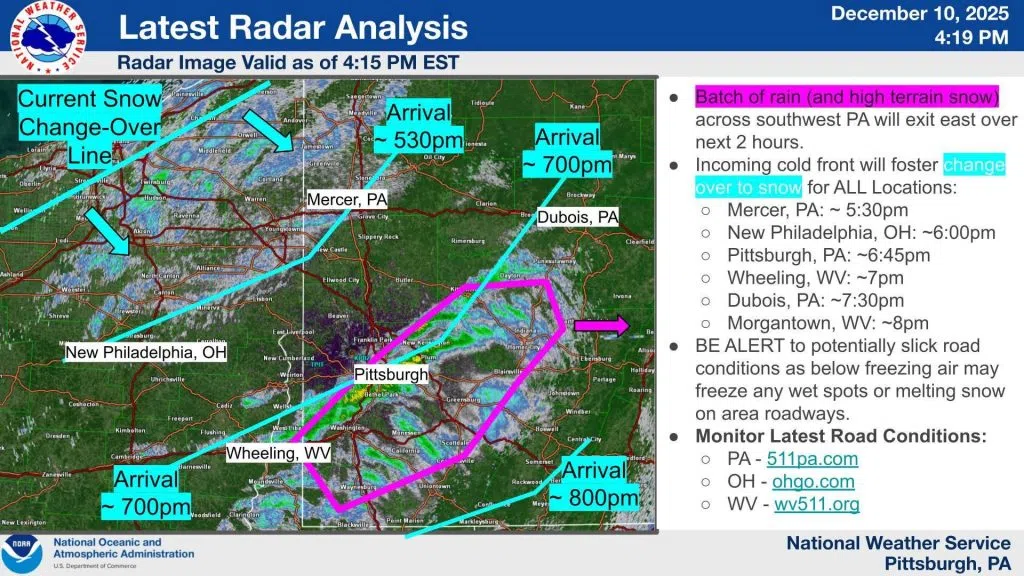
4:15pm Radar Update:
The last line of primarily rain showers (or a rain/snow or snow mix for the higher terrain) will exit southwest PA over the next 2 hours.
The cold front will arrive this evening (see approximate timing) featuring snow that could accumulate. Visit weather.gov/pittsburgh/winter to best understand the snowfall accumulation potential for your location.
Be alert to slick road conditions (especially untreated roads) as falling temperature may allow for re-freezing of wet and/or snow-covered surfaces to create icy spots.


Comments