


From the US National Weather Service
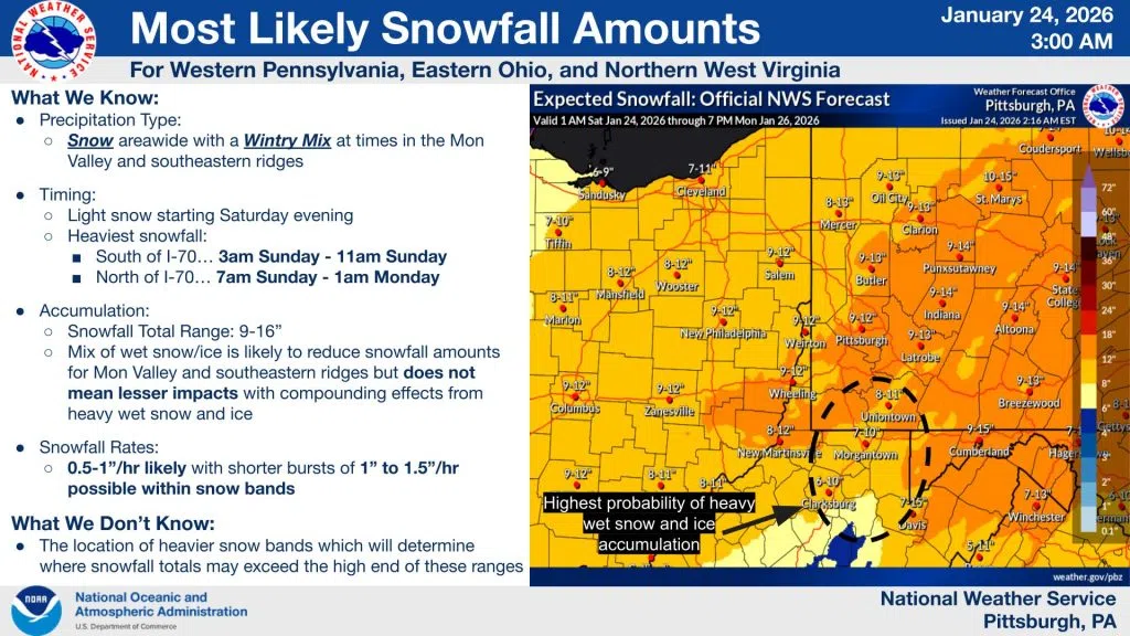
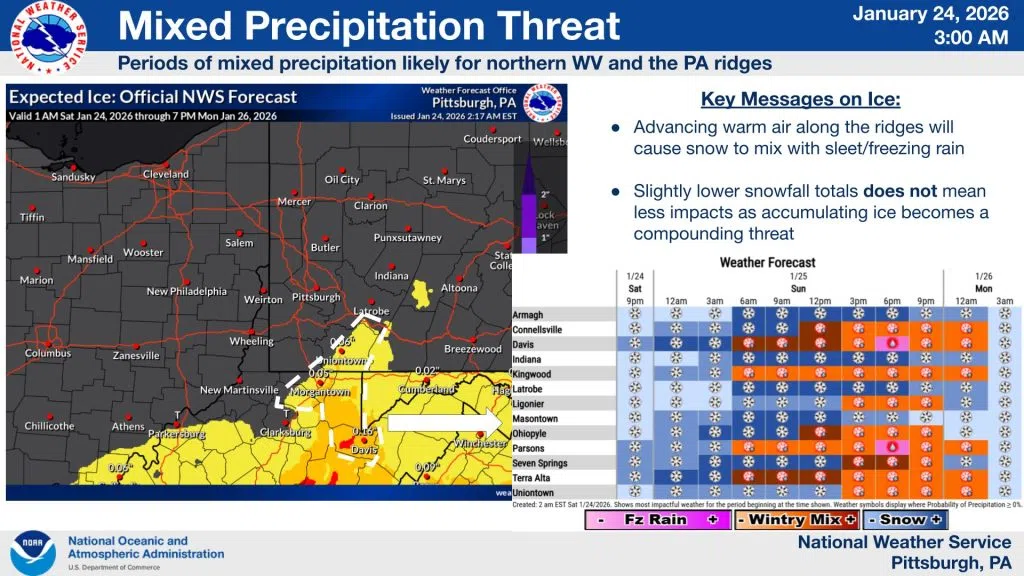
The forecast remains mostly unchanged this morning with most likely snow totals between 9-15″ across the board. We still think some sleet/freezing rain will mix in with heavier, wetter snow in northern WV and the higher elevations. If this occurs and cuts down snowfall totals by a bit, that does not mean that impacts will be lessened since the combination of a heavy, wet snow with ice will still result in hazardous conditions. Travel Saturday night and especially Sunday will be very difficult.


Comments