


Similar to earlier this week we are still looking at two main scenarios for the upcoming winter storm. Steadier snowfall is expected to begin Saturday afternoon and evening and continue into Monday.
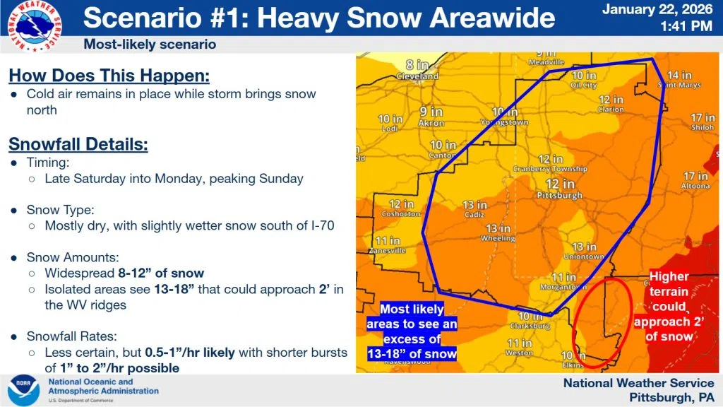
Scenario #1 Heavy snow occurs areawide.
If the colder air stays locked into the region, then heavy snowfall upwards of 8-12″ with localized accumulations possibly as high as 18″ becomes increasingly likely for much of the area. Snowfall is expected to be heaviest during Saturday night and Sunday. Hourly snowfall rates could be as high as 1-2″/hr.
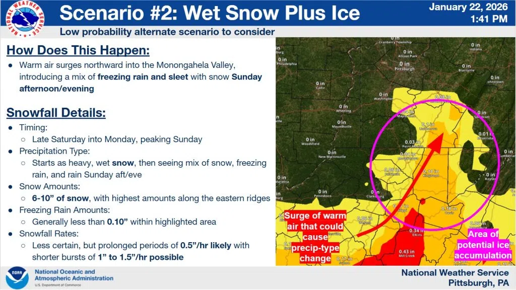
Scenario #2 Warm air sneaks into the Mon Valley, lowering snow totals and bringing ice accumulation.
Precipitation still likely begins everywhere as snow but if warm air can sneak northward into the region, the Mon Valley could see a turnover to a freezing rain/sleet/snow mix during the day on Sunday. Warmer air and a lower duration of snowfall would lead to lower snowfall totals possibly closer to 6-10″ across the Mon Valley. Ice totals are expected to be below 0.10″ but any amount of ice can cause issues. In an icier scenario, the WV ridges would be most at risk for a prolonged period of ice.
Bottom line: Either scenario brings widespread accumulating snowfall totals greater than 6″. This would represent one of the larger snow storms in the last 5 years and possibly even the last 15 years. There will be travel disruptions across the region, especially on Sunday. Models have been trending snowfall totals up but we are still 50+ hours away from the first flakes flying and we will keep you updated moving forward. Winter Storm Warning issuance is likely in the next 24-36 hours.


Comments