


From the US National Weather Service
𝐖𝐞𝐝𝐧𝐞𝐬𝐝𝐚𝐲 𝐔𝐩𝐝𝐚𝐭𝐞: “What’s the forecast for this weekend?” If you recall from yesterday, we had a discussion about long range snowfall forecasting. We discussed the closer you get to an event, the more we can narrow down the amount of potential scenarios that may play out. Over the last 24 hours, the scenario with no snow has been completely thrown out. Only 2 scenarios remain out of the original 3. Let’s call these our new scenario #1 and our new scenario #2. In both scenarios we receive snowfall, but the main question is how much?
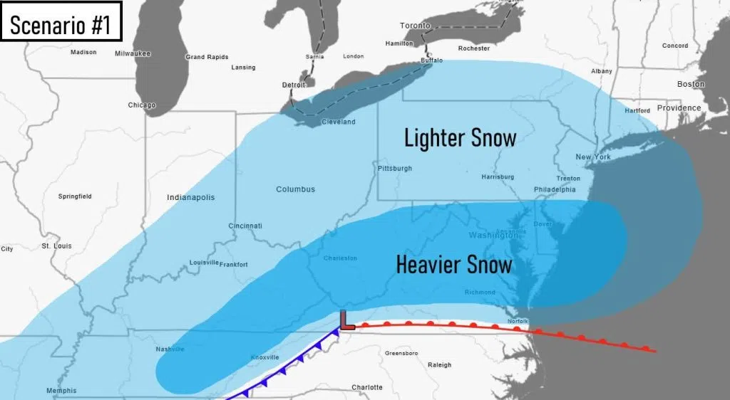
A graphic showing low pressure and fronts for the less snowy, southern track in scenario 1
Scenario #1:
To rehash from yesterday, the storm track forms to the south and then curves north as it heads towards the mid-Atlantic region. We’ll call this the southern track scenario. In this scenario, the region would see snow, but not the worst of the storm. This storm track would produce notable accumulations (>1″ but <6″). This is around 25% likely at this point given current weather prediction guidance. This probability is down from yesterday.
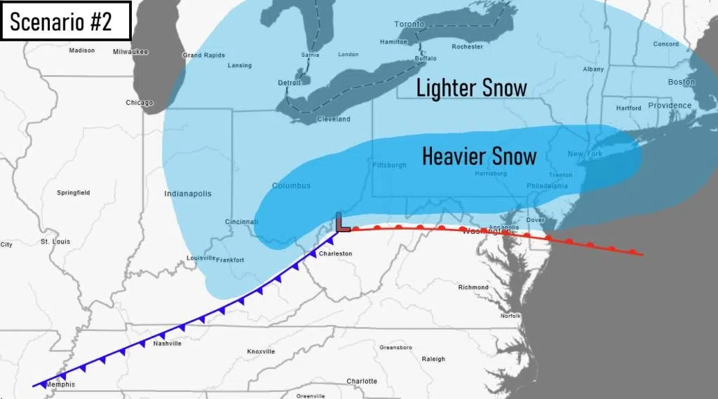
A graphic showing low pressure and fronts for a more snowy, northern track in scenario 2
Scenario #2:
To reiterate, the storm track forms to the south then curves up the spine of the Appalachians before reforming off the coast. In this scenario, the region would see some of the heaviest snow from the storm. Let’s call this the northern track scenario. This track would produce heavy accumulations (likely >6″ to as much as 15″ and even higher totals possible in the mountains). This scenario is 75% at this time given current weather prediction guidance. This is up significantly from yesterday at this time.
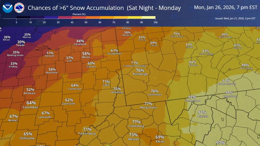
The probability of exceeding 6 inches of snow on a map spanning 7 pm Monday to 7 pm Monday
Given the upward trend in snowfall totals for Saturday night through Monday over the last 24 hours, now is the time to start thinking about how you can stay safe in the event of a winter storm. If you have any travel plans during this time period, begin thinking about contingency plans. If you plan on staying inside, make sure you have emergency supplies (food, batteries, water, portable chargers…) in your home and/or car, charged and accessible. Check your smoke and carbon dioxide detectors. Replenish fuel for your car and heating sources. Remember that you can lose power in a storm, so if you have electric heating, make sure you have alternative plans to stay warm (whether that be blankets, a fireplace, or a generator). Have a plan to check on venerable loved ones should they need help. This storm will be followed by an extended cold period, so that snow will not be going anywhere. With cold and snow, next week may be a period where you’d want to avoid extended periods outdoors.
While a winter storm watch has not been issued yet, prepare for one for portions of the area over the next 24 hours should the forecast remain on track. The highest chances of watch/warning criteria (>6″) are >50% everywhere, lowest at 60% in eastern Ohio and northwest PA, and highest at 80%-90% for the mountains of PA/WV. For the rest of the area, a winter storm watch is roughly 65% to 80% likely.
Even though snow confidence has increased, make sure to stay tuned to the forecast, as a lot can still change between now and Saturday night. Knowing the forecast, as well as the best/worse case scenarios, can keep you the most informed and prepared ahead of a snow event.


Comments