


From the US National Weather Service
If your NYE plans include late night travel, be prepared for snow❄️
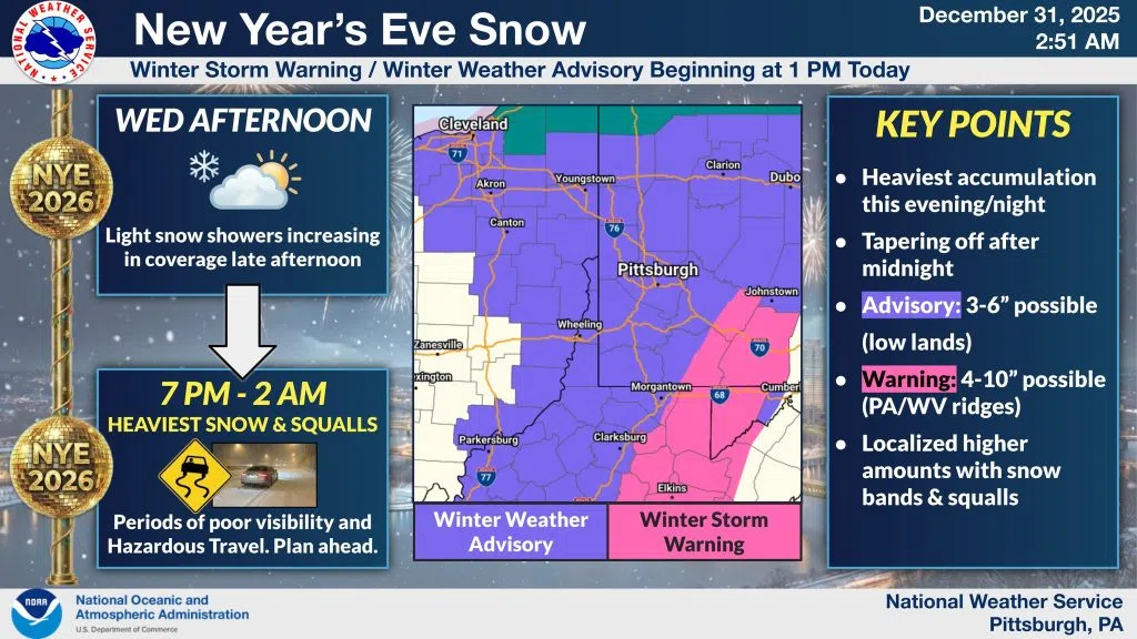
While we have a brief lull early this afternoon, widespread snow is set to return this evening as a strong front crosses the region. The Peak Window for hazardous travel is roughly 7 PM to 2 AM, which coincides directly with many people heading to or returning from celebrations.
What to expect:
❄️Intense Bursts: Rapidly moving snow bands and high squall potential could drop visibility to near zero instantly.
❄️Accumulations: General totals of 3-6″ are expected (lower in the Zanesville area), with 4-10″ possible in the ridges due to enhanced lift.
❄️Road Conditions: Expect roads to become snow-covered and slick very quickly during the peak intensity hours.
Winter Storm Warnings and Advisories begin this afternoon. If you are heading out to ring in 2026, please ensure your plans include a safe—and sober—ride that is equipped for winter conditions.


Comments