


From the US National Weather Service
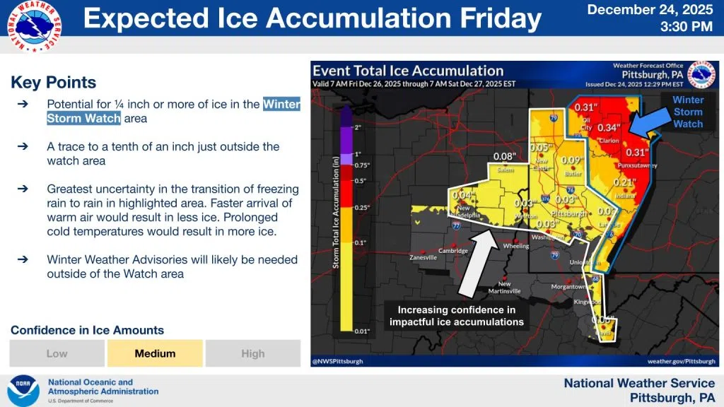
Not much change in the forecast for freezing rain on Friday. We do want to call attention to areas outside of the Watch. While probabilities for a 1/4 inch of ice are low outside the Watch, there is increasing confidence the highlighted area will see at least a glaze of ice. Expect Winter Weather Advisories to be issued in the next 12-24 hours.
Recap:
❄️Precipitation begins Friday morning or early Friday afternoon (later farther east). May be light snow in some locations at onset.
🧊Warm air aloft will quickly transition to rain (south and southwest of Pittsburgh) or freezing rain (north and east of Pittsburgh).
💧Precipitation will slowly transition back to all rain from SW to NE through the afternoon and overnight as temperatures gradually warm. This means the Pittsburgh metro will see much less ice than farther northeast where freezing rain may continue into early Saturday morning.
Impacts:
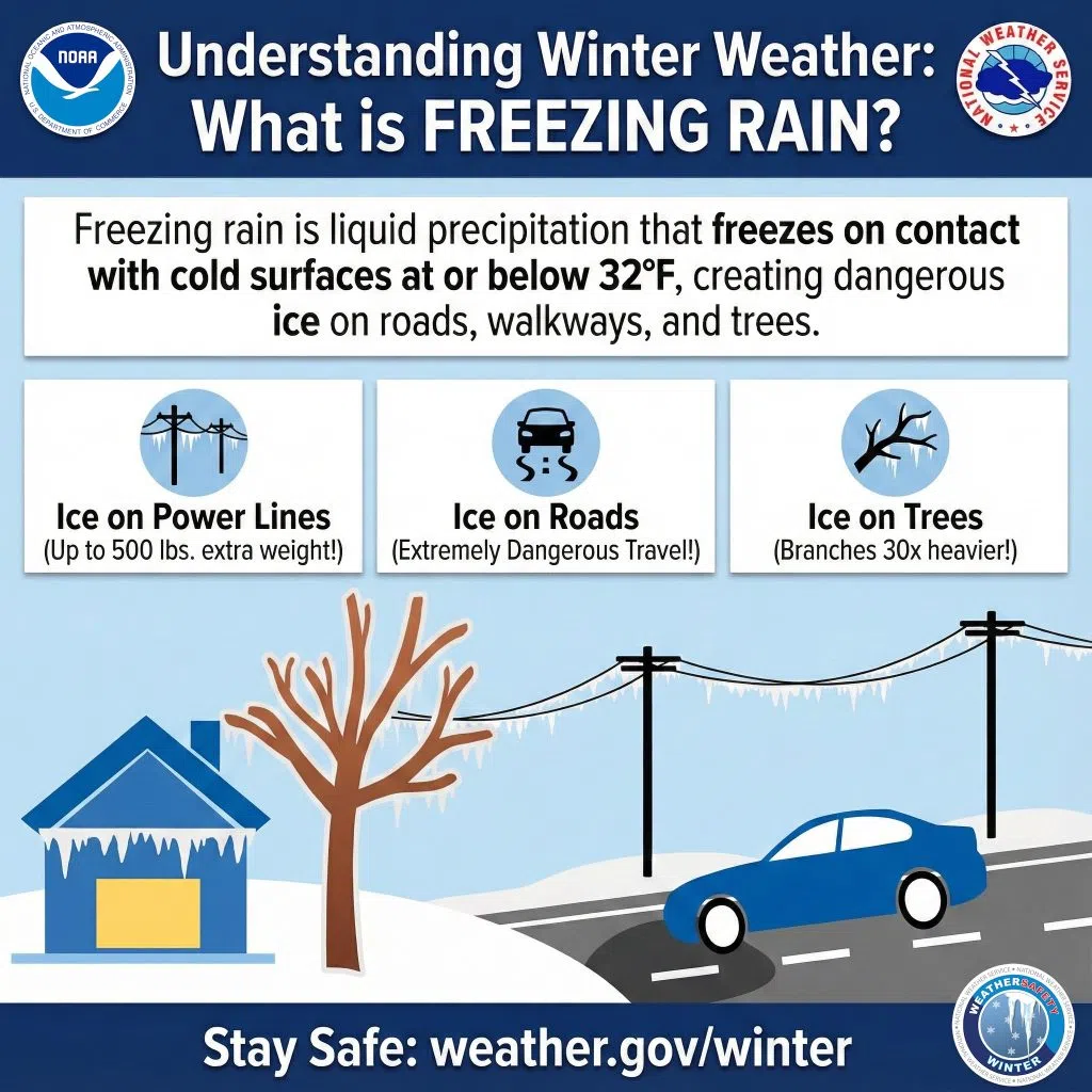
⚠️Even a light glaze of ice can create slippery conditions on roads (especially bridges) and sidewalks.
🚨0.1″-0.25″ of ice causes very hazardous driving conditions and can begin to bring tree limbs down.
‼️0.25″+ We start to see widespread power outages as tree limbs come down. Travel is very difficult.


Comments