


From the US National Weather Service
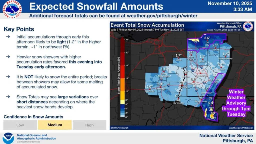
Little change was made to the snowfall forecast overnight. Scattered snow showers will continue today, with heavier bands developing this afternoon and evening. We are still expecting the most impactful accumulation north of I-80 and in the ridges. The high end snow amount potential has decreased elsewhere outside of those areas.
A small portion of the southeastern corner of Indiana County is under a Winter Weather Advisory through 1 pm on Tuesday.
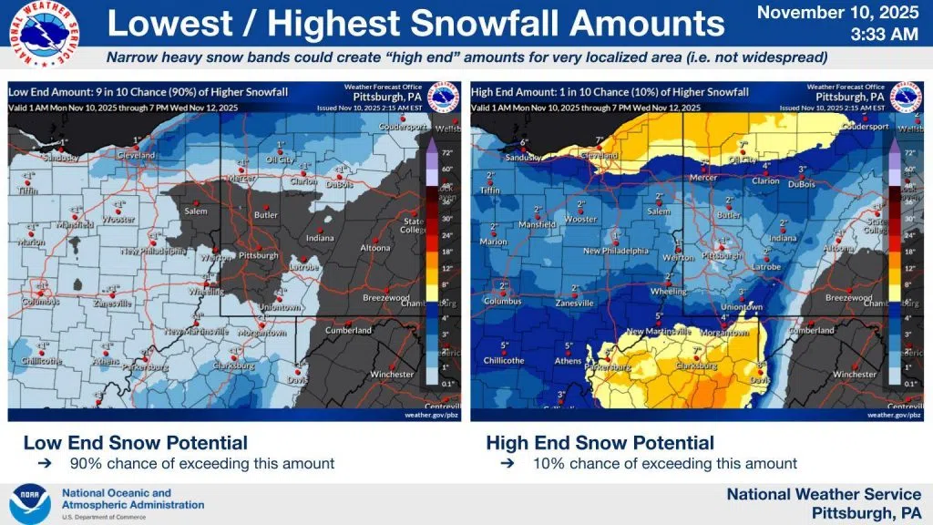
The best chance for snow appears to be after midnight tonight, with a probability of 45 percent at 2 a.m.


Comments