


From the US National Weather Service
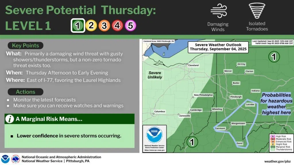
Latest model trends suggest two waves of showers and thunderstorms will cross Thursday ahead of a cold front. If enough heating can occur between these two waves, the storm environment could favor a damaging wind (and a non-zero tornado) threat. Areas SE of Pittsburgh – and just to the south of Indiana County – are slightly more likely for seeing these impacts.
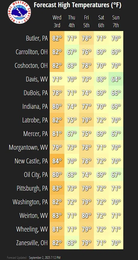
Temperatures will be a little up-and-down for the rest of the work week. Two fronts – one crossing Thursday and the next Friday night into Saturday – will provide rain chances. After the second, another run of cooler temperatures is expected.


Comments