


Update from the US National Weather Service
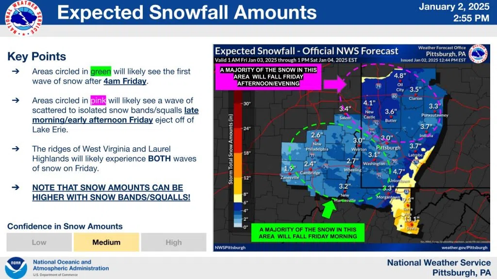
The latest “most likely” snowfall total forecast through early Saturday afternoon is shown on the first slide below. Here’s a breakdown of this fairly complex situation:
– Areas southwest of Pittsburgh (green circle on the graphic) are forecast to receive the bulk of their snow Friday morning (between 4 AM and noon), with mainly scattered afternoon/evening snow showers.
– Areas near and north of Pittsburgh (pink circle on the graphic) will see the bulk of their snow Friday afternoon and night (noon to 4 AM or so), in the form of bands of heavier snow showers and snow squalls. Lighter snow is expected Friday morning.
– Areas in the ridges will receive BOTH the more significant morning snow and heavier afternoon upslope snow showers, resulting in the higher overall totals.
The bottom line: hazardous travel conditions are possible area-wide anytime after 4 AM Friday to through Friday night. If you must travel, plan on requiring extra time!
Reported Earlier
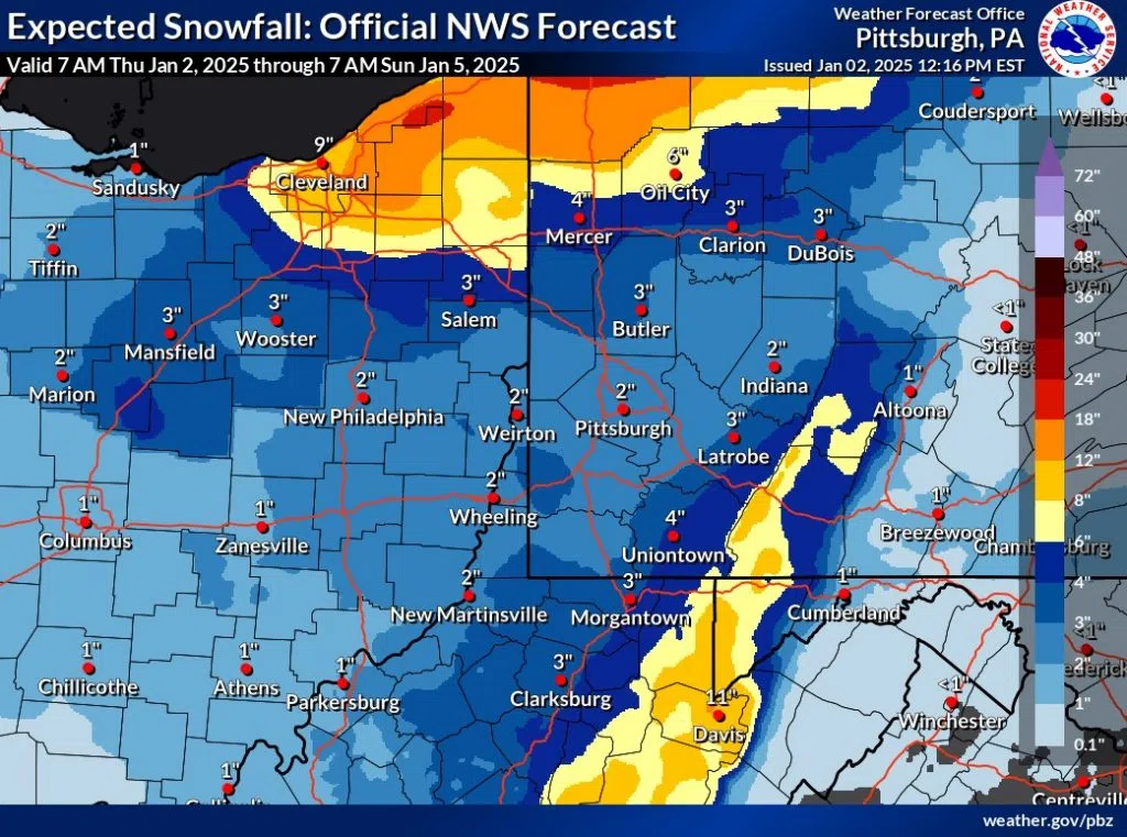
Indiana County and all of Pennsylvania will receive heavy amounts of snow during the first weekend of 2025.
Accuweather says several rounds of arctic air will plunge the northeast and central portion of the country into frigid temperatures. Along with that, approximately two-to-three inches of snow is expected, according to the National Weather Service in Pittsburgh.
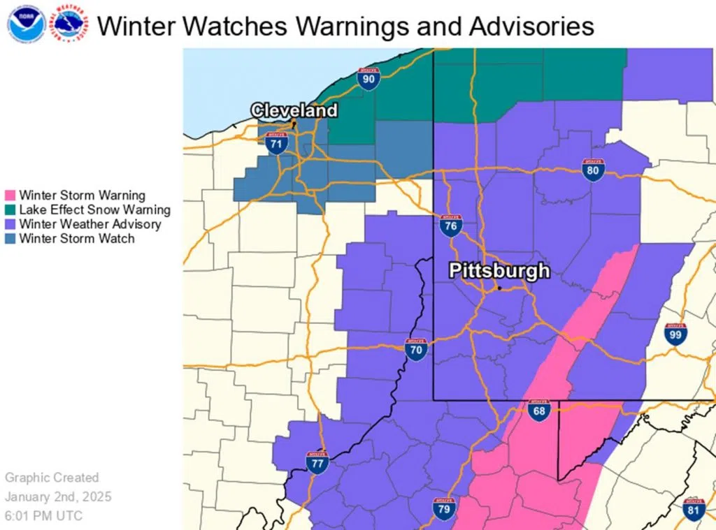
With that in mind, a Winter Weather Advisory will be in effect throughout much of the weekend, starting at 4 o’clock Friday morning and lasting until 10 o’clock Saturday morning. That could be extended, however, as Accuweather predicts the severe weather to continue into Sunday.
Stay with Your Hometown Radio Stations on-air and online for updated forecasts and weather information. If you’re going out this weekend, use 511pa.com or the 511-P-A mobile up to stay up-to-date on road conditions.
From the US National Weather Service
Here is the forecast for the expected amount of snow from the fast moving system on Friday and Saturday.
A Winter Weather Advisory has been issued for the lower elevations and a Winter Storm Warning has been issued for the ridges.
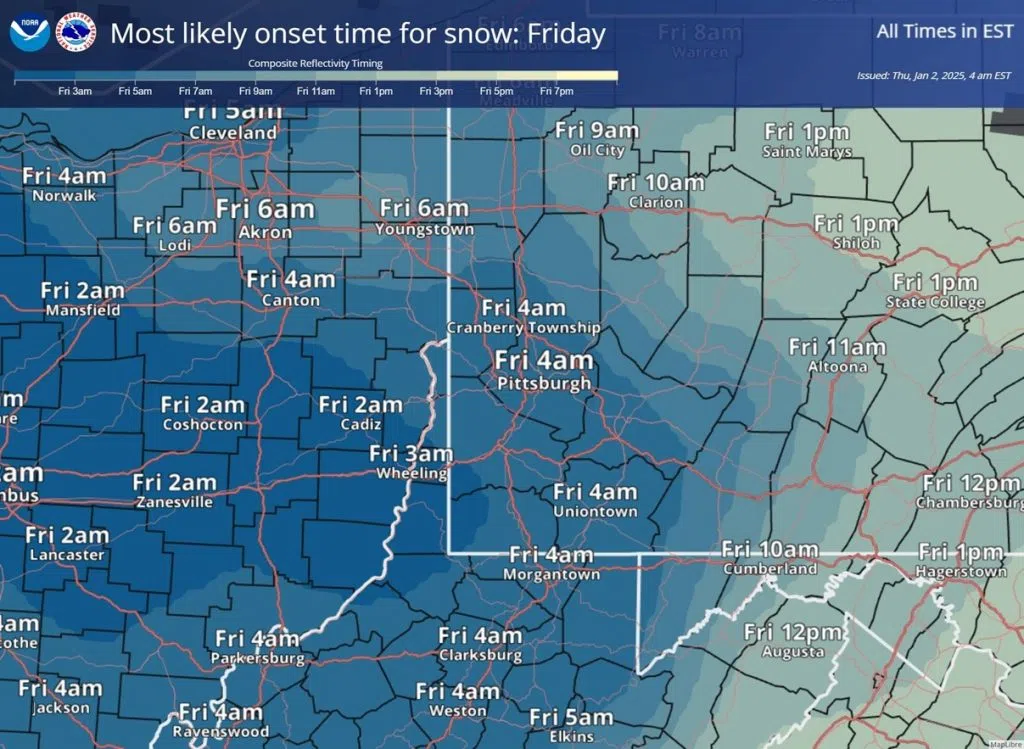
Also included is the expected onset times of the snowfall. Stay tuned for further updates.


Comments